
How Do You Survey the Shoreline of a Large Body of Water Like Okanagan Lake?
Slowly, painstakingly — and wearing lots of sunscreen or braced for wave impact
About a dozen violet-green swallows swirled in a loose circle over a patch of Okanagan Lake, arcing down for split-second taps of the surface.
We were watching from our anchored boat, the water slapping languidly against the hull.
The swallows were after midges emerging en masse from their pupal stage at the water’s surface, said Jason Schleppe, senior natural resource biologist with Ecoscape Ltd.
“That’s a sign of a good fishing spot,” he added, explaining that fish also come in to take advantage of the feeding opportunity.
Intact, natural shorelines filter water and boost biodiversity
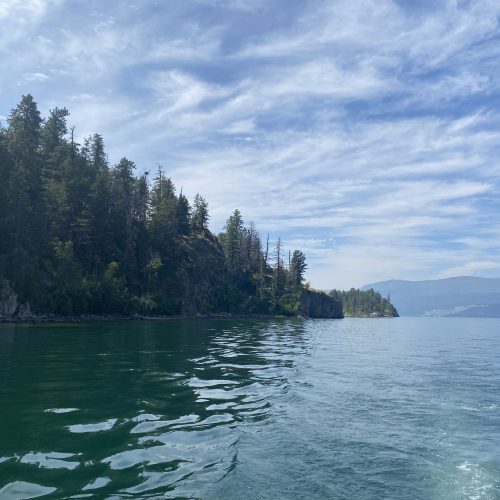
It was not a coincidence that this sign of a healthy lake ecosystem was a few metres from Ellison Provincial Park. A modest natural beach there was framed by rocky shores featuring shrubs, ponderosa pine and fir trees. That kind of intact natural shoreline keeps lake water healthy. It protects against soil erosion, filters pollutants from entering the water, provides habitat for wildlife, and cools the surrounding water and air temperature.
Those are the exact features the boat’s pilots and passengers were looking for during their mid-July calibration outing for a shoreline survey. Living Lakes Canada and project co-leads, the Okanagan Indian Band and Westbank First Nation, will work with several partners, including Ecoscape, over the next two summers to survey the lake’s 290 kilometres of shoreline and prepare a report and development guidelines for local land-use planners.
The survey checks for land use, shoreline condition, vegetation, signs of animal habitat use (such as nests), streams, and human-made structures.
The Ellison Provincial park shoreline, for example, boasted two almost fully-grown bald eaglets, which sat close to their stick nest, exercising their wings and signaling their hunger to their parents with a series of high-pitched whistling calls.
The park was a clear example of high-value, ecologically sensitive shoreline habitat. And it was very different from other long stretches of the lake, where properties featured large homes that were often accompanied by other features that will be marked in the survey, such as retaining walls, groynes (rigid, wall-like barriers built perpendicular to a shoreline), docks and swim buoys.
Survey team encompasses wide range of knowledge
Marking all these features from the back of the boat can make for long days. These are detailed observations that the Ecoscape and First Nations crews must log.
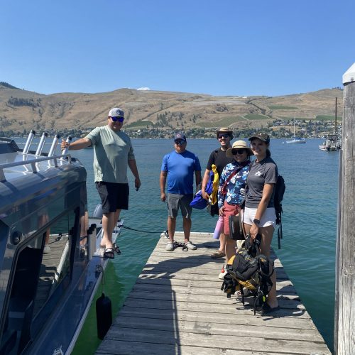
Shane Pedersen, an environmentally-focussed professional agrologist, and Lexee Kerry, a professional biologist, stood behind the cab of the boat under the hot sun and discussed exactly how they were going to mark down the various shoreline features. The boat would be going fairly slowly in order to catch everything, Pedersen said, pointing to one property’s second set of stairs down to the shoreline that were almost hidden from view.
A lot depends on the weather, too. On calm days, the sun is the biggest complicating factor. But if it’s really windy or stormy, the bigger lakes can be dangerous and uncomfortable. Kerry said one survey left them joking about having concussions, the boat hit the breakers or breaking waves that hard.
Of course, if the crew decides that it’s not safe, then the surveying stops for the day.
The boat is owned by the Okanagan Indian Band and calmly piloted by Zachary Wilson and Tyrelle Louis, of OKIB’s territorial stewardship division.
Indigenous communities have had Okanagan Lake’s pulse for millennia
Wilson noted that the lake is very low this year. “Out where I take my family you can usually dive off the dock. We’re not doing that this year,” he said.
While drought is responsible for the lake’s low levels — the lowest in decades — Wilson noted that the lake has changed immensely in the time that his people have lived on its shores.
“Our people have lived here forever — lived off this lake and everything it provides. But everything is gone now. Obviously, you can’t fix everything. But if we can fix what’s left, that would be beneficial.” A key goal for the project is to further refine the rates of loss of these natural shoreline areas to better guide governance and management.
Indigenous knowledge and perspectives are critical to this survey program. Our Indigenous partners are co-leaders of the project to ensure those values are infused throughout the report and the resulting guidance. One aspect of that knowledge is pointing out culturally sensitive areas along the shoreline, which can include a mix of traditional and contemporary fisheries uses and historic settlements.
Repeating shoreline surveys reveals important trends
This will be the fourth time the lake’s shorelines are surveyed. Repeating the survey brings trends into focus and tells those who live around the lake about whether things are improving or deteriorating. The re-survey 10 years ago showed 4.1 kilometres of the natural Okanagan Lake shoreline was lost or permanently altered since the previous survey. That may seem small compared to the total perimeter of the lake, but Schleppe calls that “death by a thousand cuts” and notes that when it includes really high-value, sensitive ecological habitat, the loss can have a disproportionate impact on the lake because so little of it remains (i.e., the loss of the little bit of high value habitat is greater than the relative area the habitat encompasses).
This year’s survey will cover just the north and central portions of the lake. Living Lakes Canada is seeking to work with local communities to co-develop and lead the second phase of the project to be conducted in the southern portion of Okanagan Lake next summer.