
PROGRAM GOAL
The goal of the Upper Columbia Basin Groundwater Monitoring Program is to increase knowledge about groundwater resources to effectively inform sustainable water management and meet the needs of people and nature.
The objectives of the Program are to:
- Collect hourly groundwater level measurements to determine how levels change seasonally and from year to year;
- Share data publicly for others to use; and
- Engage citizens in data collection and share data in easy to interpret formats to increase knowledge and awareness around groundwater.
This program's data is available on the Columbia Basin Water Hub.

WATERSHED BULLETINS
Read the latest Watershed Bulletin: Groundwater Report Flags At-Risk Aquifers for Priority Monitoring
WHERE WE ARE MONITORING
The Columbia Basin Groundwater Monitoring Program aims to monitor groundwater across a range of geological, topographical, climatic, hydrological and water use intensity conditions throughout the Basin. The Program complements the Provincial Groundwater Observation Well Network, which has a limited number of observation wells in the Basin. If you would like to monitor groundwater in your area contact us at groundwater@livinglakescanada.ca.
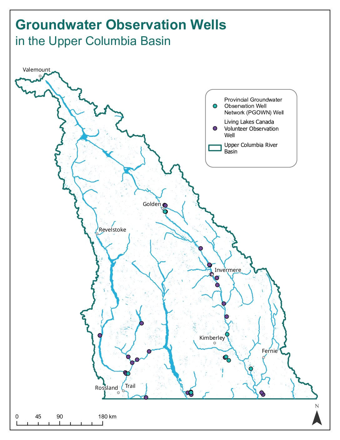
Click the map to enlarge.
View and download the Columbia Basin Groundwater Monitoring Program data, reports and resources from the Columbia Basin Water Hub here.
WHY MONITOR GROUNDWATER?
Groundwater is used in the Columbia Basin for domestic, agricultural, industrial, and commercial purposes. Groundwater helps maintain water levels and water quality in wetlands, streams, rivers, and lakes. It is vital for maintaining healthy ecosystems, including habitat for fish, waterfowl, and wildlife. Careful management and allocation of groundwater is becoming increasingly important as populations continue to grow, demand increases, and pressures such as climate change intensify.
We know that mountains are important sources of freshwater for lowlands. However, the storage and flow of groundwater in mountain environments is generally poorly understood. In the Basin, groundwater occurs in sediments (e.g., sand, gravel) and bedrock. Its distribution and supply are variable and depend on the geology, proximity to areas of recharge and discharge, and climate. In many areas within the Basin groundwater is hydraulically connected to surface waters and feeds wetlands, streams, rivers, and lakes. Although the Upper Columbia Basin is only 15 percent by area of the larger entire Columbia Basin Watershed, it provides about 40 percent of the annual flow.
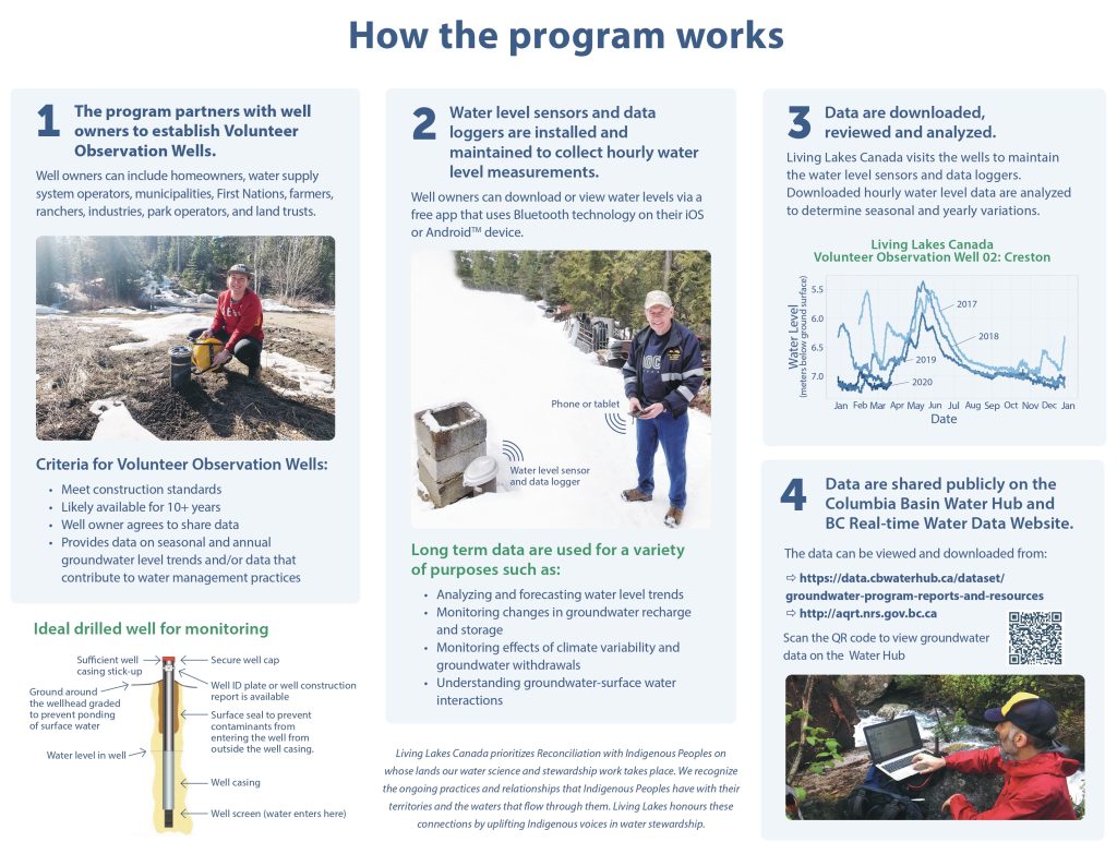
Groundwater systems are dynamic and adjust to short and long-term changes in climate, groundwater withdrawals, and land cover. Data is needed to understand how groundwater responds to these changes and ensure supply is available for people and for flow to surface waters. Groundwater level data can be used to:
- Analyze and forecast water level trends,
- Monitor changes in groundwater recharge and storage,
- Monitor effects of climate variability and groundwater withdrawals,
- Understand groundwater-surface water interactions, and
- Inform water management decisions (e.g. water licensing decisions)
- Inform direct conservation actions (e.g. identifying and protecting groundwater recharge and discharge areas for stream and river ecosystems that are dependent on groundwater).
FIND THE DATA ONLINE
- Data is available on:
OUR TEAM
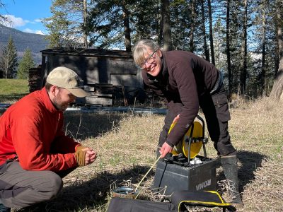
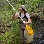
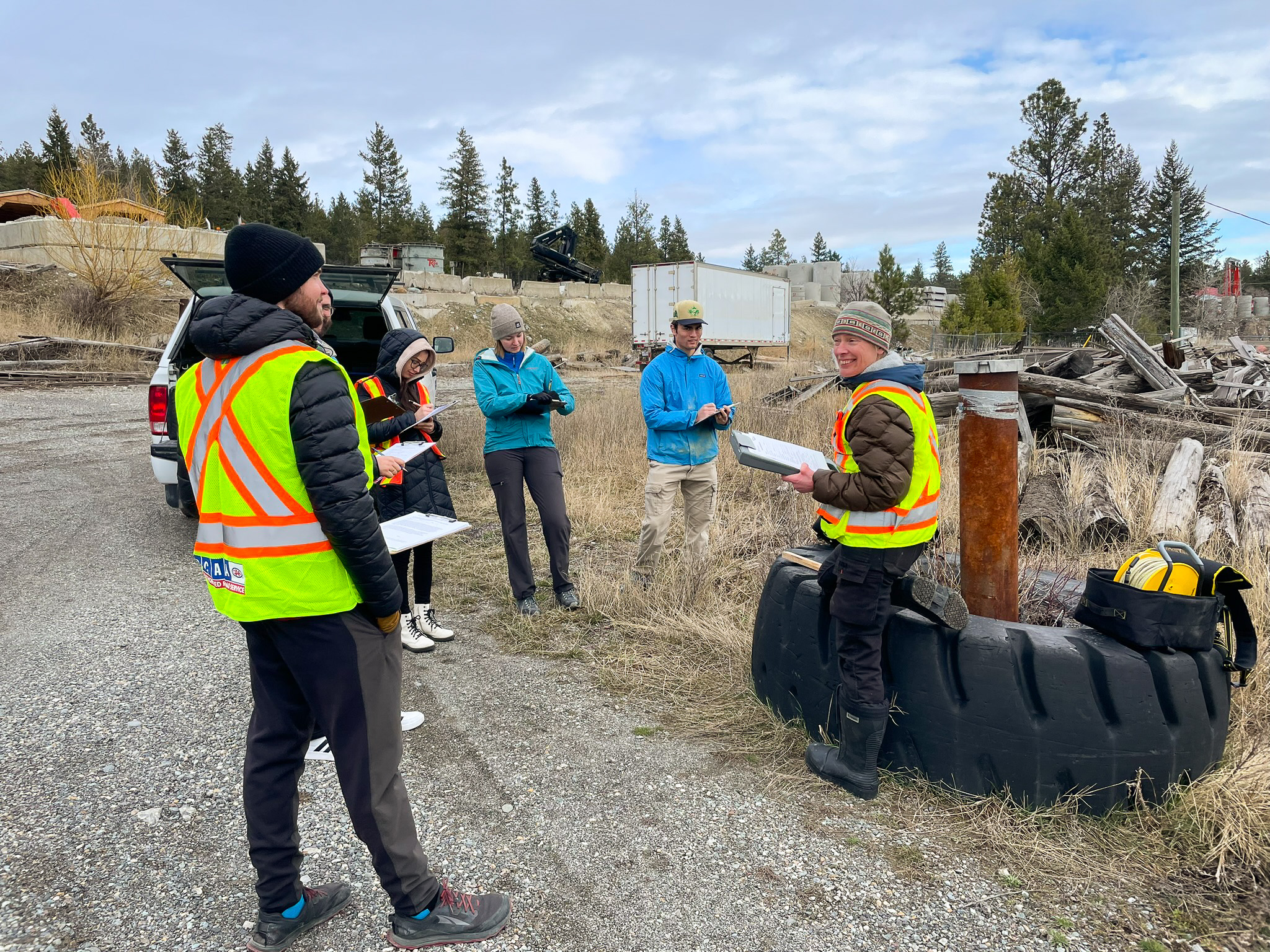
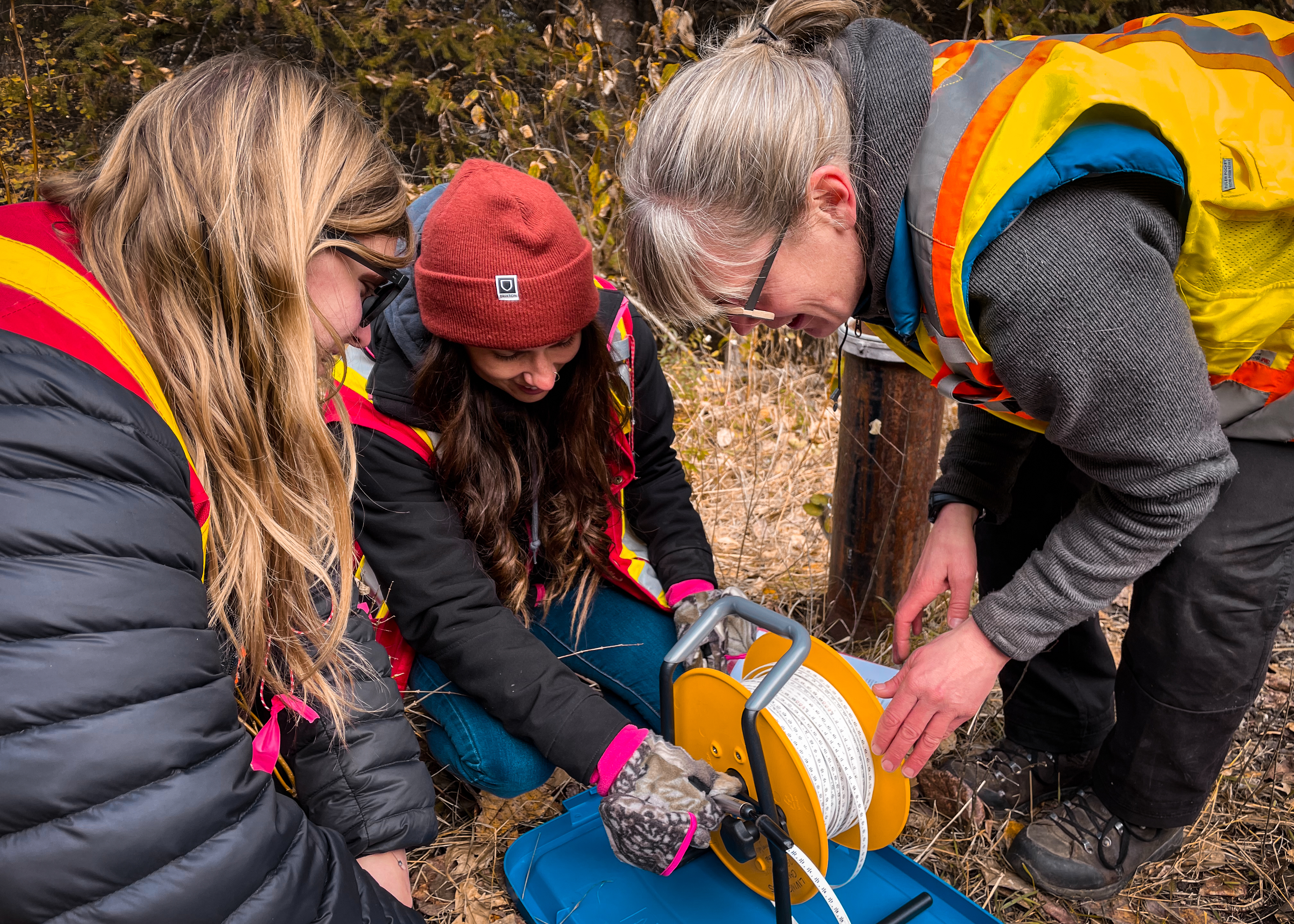
Volunteer Well Owners
The foundation of the Program are the well owners who volunteer their wells for monitoring. These include municipalities, First Nations, and private landowners. To date, Volunteer Observation Wells have been established in collaboration with ʔaq̓am, City of Castlegar, City of Cranbrook, District of Invermere, Kala Geosciences, McDonald Ranch and Lumber, Nature Trust of British Columbia, Selkirk College in Castlegar, Playmor Water Utility, Regional District Central Kootenay, Village of Canal Flats, Village of Radium Hot Springs, Yaq̓it ʔa·knuqⱡi ‘it First Nation, and private landowners throughout the Basin.
CONTACT
Contact us to discuss:
- Volunteering your well
- Your data needs
- Partnership opportunities
- Making a donation and receiving a charitable tax receipt
- Assistance accessing data
- How to learn more about groundwater in your area
Email: groundwater@livinglakescanada.ca.
ADDITIONAL RESOURCES
- Groundwater level monitoring and the importance of long-term water level data – Publication by the US Geological Survey
- Mountain Block Recharge: A review of current understanding – A summary of our understanding of groundwater flow from mountains to valley bottoms.
- BC Groundwater Wells and Aquifers – Provincial databases of wells and aquifers in BC and links to provincial groundwater information.
- Agriculture and Agri-Food Canada well monitoring – Information on assessing the operation and condition of your well.
- Important information for well owners in BC – Information for well owners on if they need to register or license their wells.
- BC Groundwater Protection Regulation – Information on the regulations to ensure activities related to wells and groundwater are performed in an environmentally safe manner.
News and Updates
A report on the Columbia Basin’s groundwater identifies multiple areas of concern (radio interview) – CBC Daybreak South, Jan 22 2026
Living Lakes Canada report warns of at-risk aquifers, monitoring gaps – Water Canada Magazine, Jan 22 2026
Protecting groundwater in the Kootenays with centralized modern data management (pg. 43) – Environmental Science & Engineering Magazine, August 2025
Groundwater and Agriculture in the Columbia Basin (recording of live session) – Living Lakes Canada, Apr 2 2025
Understanding groundwater’s crucial role in Basin agriculture – E-KNOW.ca, Mar 22 2025
Regional district application for groundwater, aquifer vulnerability studies – Castanet, Oct 3 2024
Resources
- Groundwater 101: Understanding Groundwater and Why it Matters
- Webinar: Groundwater & Agriculture in the Columbia Basin (April 2, 2025)
- Finding Freshwater in New Episode of The Headwaters Podcast
- Watershed Bulletin: Spring Groundwater Levels Highlight Variability and Need for Expanded Monitoring
- 2023 Data Download Instructions for Well Owners
- 2021 CBWM Film Series – Groundwater Monitoring
- Wells, Water Levels, and Windermere Creek: Exploring Current Groundwater Data and 3D Modelling (2021)
- Columbia Basin Groundwater Monitoring Program Informational Handout
- 2021 Memo: Groundwater Levels to Date for Living Lakes Canada Volunteer Observation Wells
- 2021 Windermere Preliminary Hydrogeological Characterization
- 2021 Windermere 3D Model and Viewer Instructions
- 2020 Data Collection Summary
- 2020 Program Overview Video
- 2019 Program Data Summary
Funders & Contributors
 |
 |
 |
|
 |
 |
 |
 |
 |
|
 |
