

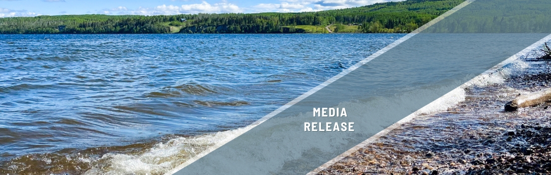
Summer survey will assess the health of Lac La Biche’s shoreline
It can be hard to track gradual change, especially over a large, spread out area. This is what will make this summer’s resurvey of Lac La Biche’s 167 kilometres of shoreline so valuable.
Alberta’s seventh-largest lake provides significant ecological, cultural, social and economic value to the region, including clean water, abundant fish populations and natural shorelines for recreation. Healthy shorelines play an important part in supporting those values. They reduce erosion, protect water quality, support biodiversity, and maintain the recreational and cultural values that underpin community livability and identity.
But growing development and environmental pressures are threatening the health and long-term resilience of Lac La Biche’s shoreline. This is why Living Lakes Canada and local partners will launch what is called a Foreshore Integrated Management Planning (FIMP) project this summer to reassess shoreline conditions, identify priority habitats and restoration areas, and support sustainable shoreline management through science-based planning and development recommendations, habitat restoration and long-term community stewardship.
“We want residents and visitors to continue to enjoy all the benefits that a healthy Lac La Biche brings to their lives,” said Georgia Peck, FIMP Program Manager with Living Lakes. “A survey like this will draw attention to the actions needed to keep their lake in good condition and improve in areas where the shoreline damage has occurred.”

This work will build off of the 2017 Lac La Biche FIMP survey, which found significant habitat loss and shoreline disruptions, highlighting the need for further FIMP assessments in the region. This approach has been successfully applied to 16 lakes in B.C. since the methodology was updated in 2020, and this will be Alberta’s first FIMP reassessment using the standardized national protocol, establishing a precedent for repeatable, data-driven shoreline management in the province.
Lac La Biche supports diverse fish populations, including northern pike, yellow perch, cisco, burbot, walleye and lake whitefish, while the surrounding landscape provides important habitat connectivity for wildlife across provincially recognized biodiversity corridors. Located within the Zone 1 Provincial Game Bird Sanctuary and designated as an Important Bird Area, the lake also supports numerous migratory and breeding bird species, including American white pelicans, bald eagles, great blue herons, trumpeter swans, sandhill cranes and western grebes.


The project is supported by a strong network of partners, including Lac La Biche County, Healthy Waters Lac La Biche, Alberta Lake Management Society (ALMS), the Athabasca Watershed Council, the North Saskatchewan Watershed Alliance, and Portage College.
“Lac La Biche County is excited to be involved in and support this important project,” said Julia Shapka, coordinator of Environmental Services for Lac La Biche County. “The health of Lac La Biche is one of our top priorities, and this work will provide valuable information to help guide future shoreline management, conservation, and restoration efforts.”
As part of the survey, drone imagery will be captured along the Lac La Biche shoreline. Residents and visitors may see or hear drones in use during the summer. The drone surveys will be used to assess land use, shoreline condition, vegetation, streams, and human-made structures, and help detect changes caused by development or natural disturbances.
All drone operations will strictly follow federal regulations, the Government of Canada’s drone operator guidelines, and the Personal Information Protection Act (PIPA). Drones will be flown at heights that prevent identification of individuals, faces, names or licence plates.
The shoreline data collected will be compiled in a report that will be released in spring 2027. Based on the survey findings, foreshore development guidelines will be developed and shared with local communities, First Nations, and local governments to support sustainable lake planning and decision-making.
This project is being undertaken with the financial support of Lac La Biche County, Alberta Conservation Association, and Alberta Innovates.
Georgia Peck, Living Lakes Canada program manager of Foreshore Integrated Management Planning, is available for comment.
-30-
Background
- Foreshore is defined as the land between the high and low watermarks of streams, rivers, lakes, and the ocean.
- In 2017, the FIMP survey found natural area still occupied 65 per cent of Lac La Biche’s shoreline, followed by commercial (12 per cent), single family (11 per cent), and natural park (11 per cent). Agriculture, recreation and industrial land use proportions were each less than one per cent.
About Living Lakes Canada
Living Lakes Canada is a national non-profit organization based in the B.C. Columbia Basin working towards the long-term protection of Canada’s freshwater. Visit https://livinglakescanada.ca/ for more information.
Contact
Hanneke Brooymans
Communications Team Lead
587-336-4396

