

St. Mary Lake foreshore survey report now available
As the popularity of St. Mary Lake grows, both as a recreational hotspot and a scenic place to live, monitoring the lake foreshore is just as important as monitoring lake water quality.
The lake foreshore is defined as the area along the lake between the low and high water mark, and is extremely valuable ecologically, culturally and economically. Around ninety percent of all lake biodiversity is found in the foreshore; it provides habitat for fish, nesting waterbirds, breeding amphibians, shorebirds and more. Culturally and archaeologically-significant sites may be found there. Erosion, flooding, and waves all impact the foreshore, and can cause extensive damage to properties and habitats.
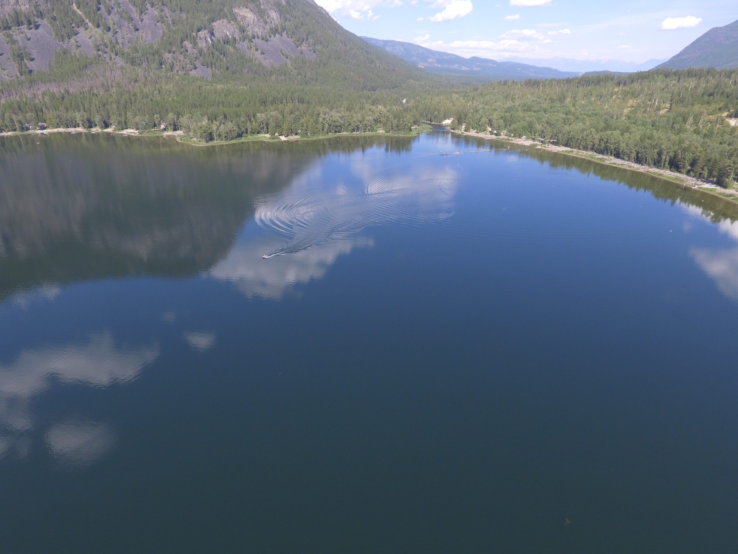
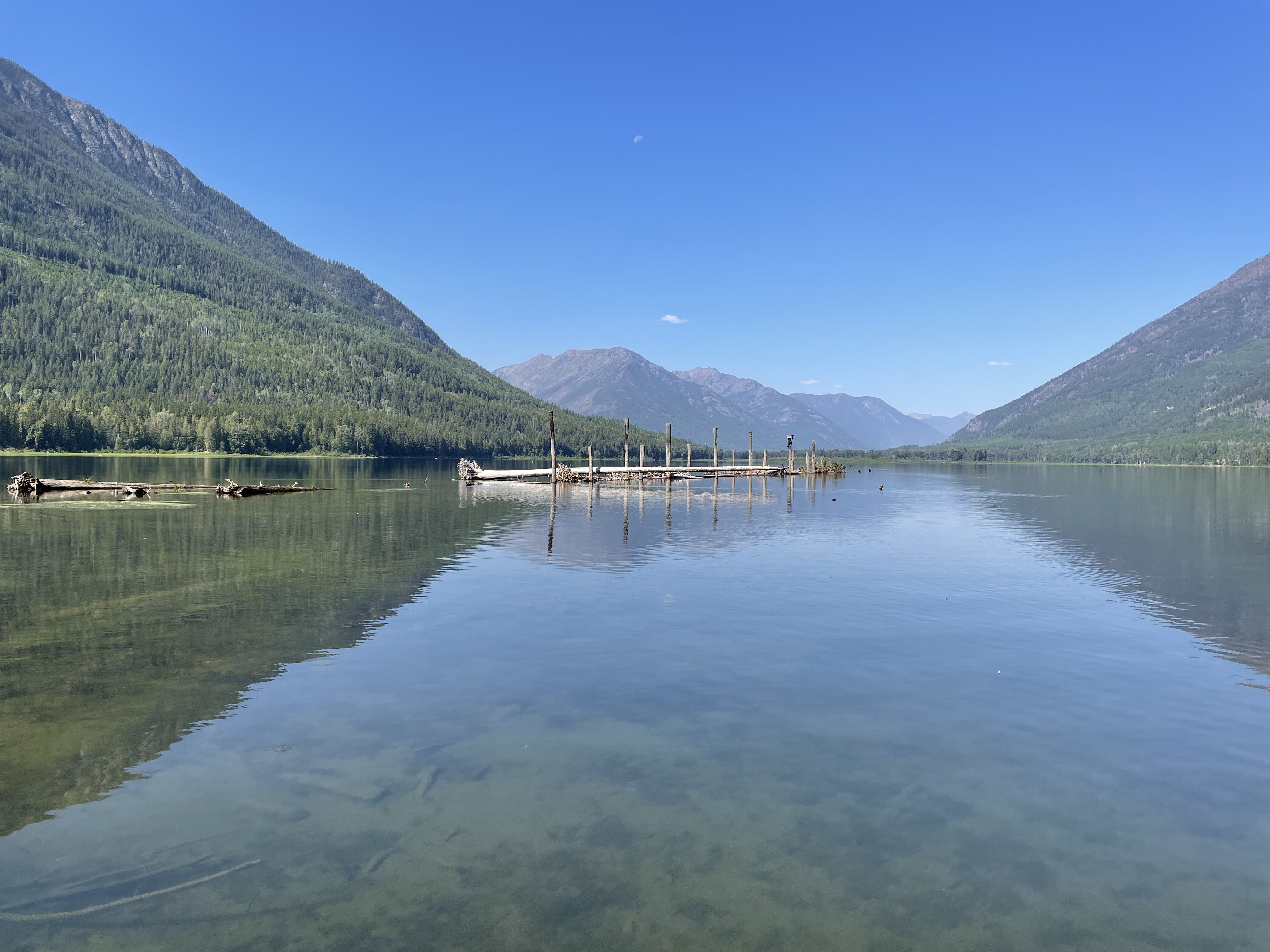
St. Mary Lake FIMP survey in September 2022. LLC Photo
Negative impacts and changes to lake foreshore can occur slowly over time and can also be difficult to detect. Living Lakes Canada has studied the foreshore of St. Mary Lake using a federal monitoring protocol called Foreshore Integrated Management Planning, or FIMP. This was done in 2010 and again in 2022 to determine how much the lake foreshore health had changed over the years. The monitoring can also highlight the effectiveness of lake management policies implemented by all levels of government as well as considering important Indigenous cultural values, species risk and their habitat.
“The purpose of a FIMP re-survey is to return to a lake roughly 10 years after the first survey and assess the rate of change in urban development and ecological parameters, and to audit the best management practices and guideline compliance along the shoreline,” said Georgia Peck, FIMP Manager with Living Lakes Canada. “St. Mary Lake supports several fish species including Bull Trout, Burbot, Kokanee, Longnose Sucker, Mountain Whitefish, Rainbow Trout and Westslope Cutthroat Trout. Through the 2022 re-survey of the St. Mary Lake foreshore, Living Lakes Canada seeks to support future land use planning with the goal of conserving this ecologically rich habitat and the biodiversity that depends on it.”
The foreshore survey was carried out by boat using GPS, and drone assessment. The comprehensive survey cataloged multiple observations: land-use (industrial, residential, commercial), shore type (cliff/bluff, rocky shore, sand beach), foreshore condition, the number of docks, weirs or other man-made developments, wildlife, vegetation, and many others.
The 2022 St Mary Lake findings can be found in a FIMP report in the Columbia Basin Water Hub database, including Foreshore Development Guidelines.
“The Foreshore Development Guidance document is a resource that can be referenced by government, First Nations, stewardship groups, property owners, or anyone wishing to learn more about the quality of habitat on the foreshore and the risks posed by different shore-altering activities,” said Peck.
The St. Mary Lake study area included a total of 10.5 kilometres of shoreline, broken into nine segments. More than two-thirds of the shoreline (7,360 metres or 70.4%) was in natural condition while the remainder was disturbed (3,090 m or 29.6%).
A comparison between the 2010 and 2022 surveys indicates that the total length of disturbed shoreline increased substantially by 560 m (or 5.4%) in the last 12 years, from 2530 m to 3090 m. Much of these changes occurred over a 1-2 year period. Almost a quarter of these changes (23.4%) are rated as High Impact while 68.7% are rated
The survey determined that the main shoreline modifications were roads (21%), followed by the removal of riparian vegetation for logging and new property development (including but not limited to cabins and residences, boat launches, docks, retaining walls, and fences). Due to these modifications, a “High” level of impact was measured on 23.4% of the disturbed shoreline, while 68.6% of the disturbed shoreline was assigned a “Medium” impact rating.
Overall, the ecological integrity of St. Mary Lake was largely rated as Very High (44.1%), followed by Medium (20.4%), Low (15.4%), High (12.1%), and Very Low (8.0%).
The community of ʔaq̓am (formerly known as the St. Mary’s Indian Band) is the closest First Nation community to the study area. During the planning phase of this project, Living Lakes Canada reached out to the ʔaq̓am community which showed an interest in participating in the field component of this assessment though a member of the community was not available to participate. Further consultation with the Ktunaxa Nation and the community of ʔaq̓am will help define the cultural significance of this area.
“The second inventory of the current shoreline values and features of St. Mary Lake conducted in 2022 provides an important opportunity to monitor and assess changes to the shoreline,” said Karen MacLeod, Planning Supervisor with the Regional District of East Kootenay (RDEK). “Protocols such as the FIMP process are an important tool for local governments such as the RDEK to identify and implement regulatory tools to protect sensitive environmental areas. The new FIMP documents provide valuable information to assist local government in the development of policies and development application procedures and facilitating knowledge sharing with local landowners.”
Living Lakes Canada entered a four-year Contribution Agreement with Fisheries and Oceans Canada (DFO) and their Canada Nature Fund for Aquatic Species at Risk Program in 2019 to review and revise the FIMP methodology and map or re-map up to eight lakes. To date, four lakes have been surveyed for the first time and six lakes have been re-surveyed through the program.
To learn more, email georgia@livinglakescanada.ca.
