

Columbia Lake foreshore survey report now available
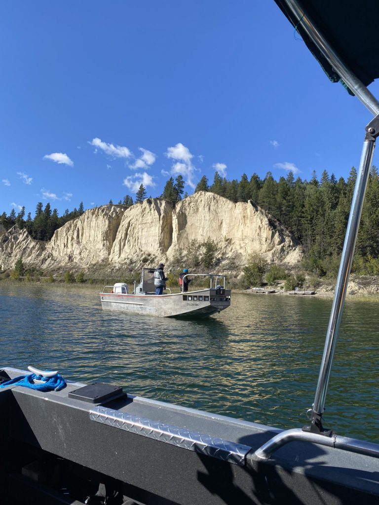
Columbia Lake FIMP survey in September 2021. LLC Photo
As the popularity of Columbia Lake grows, both as a recreational hotspot and a scenic place to live, monitoring the lake’s foreshore is just as important as monitoring the lake’s water quality.
The lake foreshore is defined as the area along the lake between the low and high water mark, and is extremely valuable ecologically, culturally and economically. Around ninety percent of all lake biodiversity is found in the foreshore; it provides habitat for fish, nesting waterbirds, breeding amphibians, shorebirds and more. Indigenous archaeological and culturally significant sites may be found there. Erosion, flooding, and waves all impact the foreshore, and can cause expensive property damage.
Negative impacts and changes to lake foreshore can occur slowly over time and can also be difficult to detect. Living Lakes Canada has studied the foreshore of Columbia Lake using a federal monitoring protocol called Foreshore Integrated Management Planning, or FIMP. This was done in 2009 and again in 2021 to determine how much the lake foreshore health had changed over the years. The monitoring can also highlight the effectiveness of lake management policies implemented by all levels of government as well as considering important Indigenous cultural values, species risk and their habitat.
“The purpose of a FIMP re-survey is to return to a lake roughly 10 years after the first survey and assess the rate of change in urban development and ecological parameters, and to audit the best management practices and guideline compliance along the shoreline,” said Georgia Peck, FIMP Manager with Living Lakes Canada. “Columbia Lake was one of the priority lakes selected last year because of development pressures and the presence of multiple at-risk species.”
The foreshore survey was done by boat using GPS, and aerial photograph assessment. The comprehensive survey cataloged multiple observations: land-use (industrial, residential, commercial), shore type (cliff/bluff, rocky shore, sand beach), foreshore condition, the number of docks, weirs or other man-made developments, wildlife, vegetation, and many others.
The 2021 Columbia Lake FIMP findings can be found in a report in the Columbia Basin Water Hub database, including updated Columbia Lake Foreshore Development Guidelines.
“The Foreshore Development Guidance document is a resource that can be referenced by government, First Nations, stewardship groups, property owners, or anyone wishing to learn more about the quality of habitat on the foreshore along with the evidence-based development guidelines,” said Peck.
A comparison between the 2009 and 2021 surveys indicates that the total length of disturbed shoreline increased slightly by 75 m (0.2% of the total shoreline) from 16,116 m (40.7%) to 16,191 m (40.9%). While this overall amount of change is very low, several types of shoreline modifications increased over the 12 years by approximately 100% including docks (from 14 to 30), groynes (from 4 to 7), and retaining walls (from 5 to 11). The increase in retaining walls affected an additional 224 m of shoreline, an increase of approximately 25%. The number of boat launches increased by 30% while the number of marinas and the shoreline modified by railways and roadways was unchanged.
Local Indigenous participation ensured that Traditional Ecological Knowledge and cultural values were captured in the foreshore study via a desktop review of reports.
“The results of the FIMP update will be used in developing the final draft of the Columbia Lake Management Plan Update,” said Nancy Wilson with the Columbia Lake Stewardship Society. “We are grateful to have updated FIMP survey results to fill knowledge gaps and help in the development of the updated lake management plan.”
Living Lakes Canada entered a four-year Contribution Agreement with Fisheries and Oceans Canada (DFO) and their Canada Nature Fund for Aquatic Species at Risk Program in 2019 to review and revise the FIMP methodology and map or re-map up to eight lakes. To date, five lakes have been re-surveyed and two additional lakes have been surveyed through the DFO-funded program.
To learn more, visit fimp.cbwaterhub.ca or email georgia@livinglakescanada.ca.

