

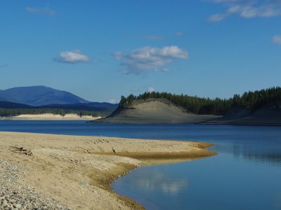
Lake Koocanusa is a reservoir on the Kootenay River system formed by the creation of the Libby Dam in Montana in 1973. Straddling Canada and the USA, it includes important trans-boundary migratory routes for wildlife, and provides valuable habitat for birds, fish, terrestrial plants and mammals. A unique mixing zone, sensitive grasslands surround the reservoir, which experiences a 30 foot fluctuation in water levels, and supporting multiple Species of Conservation Concern, including: burbot, kokanee, bull trout, westslope cutthroat trout, and long-billed curlew. Recently, significant recreational land-use pressures have escalated with uncontrolled off-road vehicle use and uncontrolled camping. More than 100,000 people visit the lake each year, the majority of them from Alberta, to recreate on the land and water.Upstream industrial impacts from five open-pit coal mines in the Elk Valley add to stresses on the system. Alarmingly high levels of selenium have resulted in a joint request from the Ktunaxa Nation, the Confederated Salish and Kootenai Tribes and the Kootenai Tribes of Idaho to the Canadian and American federal governments to refer the Kootenay River water quality concerns to the International Joint Commission.Cumulatively, these pressures have sparked increased community engagement, the development of an Official Community Plan for the Koocanusa area and a Recreation Management Planning process. Led by regional government and First Nations, the plan will be an avenue to address a number of recreational issues, including the extensive off road vehicle use that occurs in the area and is known to impact wildlife values. Sensitive Habitat Inventory Mapping (SHIM) is a protocol developed by Fisheries and Ocean Canada which provides decision-makers, planners, developers, landowners and government agencies with the knowledge and tools required to make sustainable foreshore land-use decisions that take into account cumulative impacts to fish and wildlife habitats from development pressures.
Phase 1 of the project was completed in 2015, and included Foreshore Inventory Mapping and a Fish and Wildlife Habitat Assessment, which identified new critical nesting sites for the long-billed curlew. Long-billed curlew are Blue-Listed in British Columbia and federally listed as a Species of Special Concern. Habitat for these shorebirds is threatened through urbanization, conversion of native grasslands to agricultural crops, forest encroachment, soil erosion and recreational disturbances threaten these shorebirds. New nesting sites must be protected and existing protections must be maintained through land-use planning and enforcement of recreation and access management. These guidelines will be critical inputs to land and water-use planning currently underway, specifically to protect critical long-bill curlew nesting sites identified in Phase 1 and maintaining existing protections through management and enforcement.
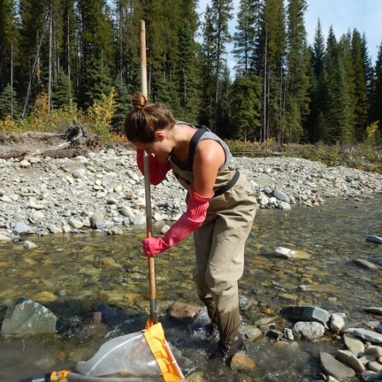
Phase 2 will include the analysis of data collected in Phase 1 through the application of an Aquatic Habitat Index, which identifies the level of risk associated with various land use activities such as docks, retaining walls, and off road vehicle use. The expected outcomes include mapping that will identify recreational access points and restricted areas and develop Shoreline Management Guidelines that will guide foreshore alterations in a manner that will protect high value habitat. The project aims to influence the type of, and area of land, that is set aside for conservation including sensitive nesting habitats for long-billed curlews, a species of special concern. To achieve conservation designations, community outreach and education will be key to address the underlying cause of the problem.
