

Mitigating Hydrologic Vulnerability in the Columbia River Wetlands
 Living Lakes Canada (LLC) team members Kyle Prince and Georgia Peck returned to the Columbia River Wetlands in early May 2021 to assist the Columbia Wetland Stewardship Partners (CWSP) with their Hydrologic Vulnerability study for the second year.
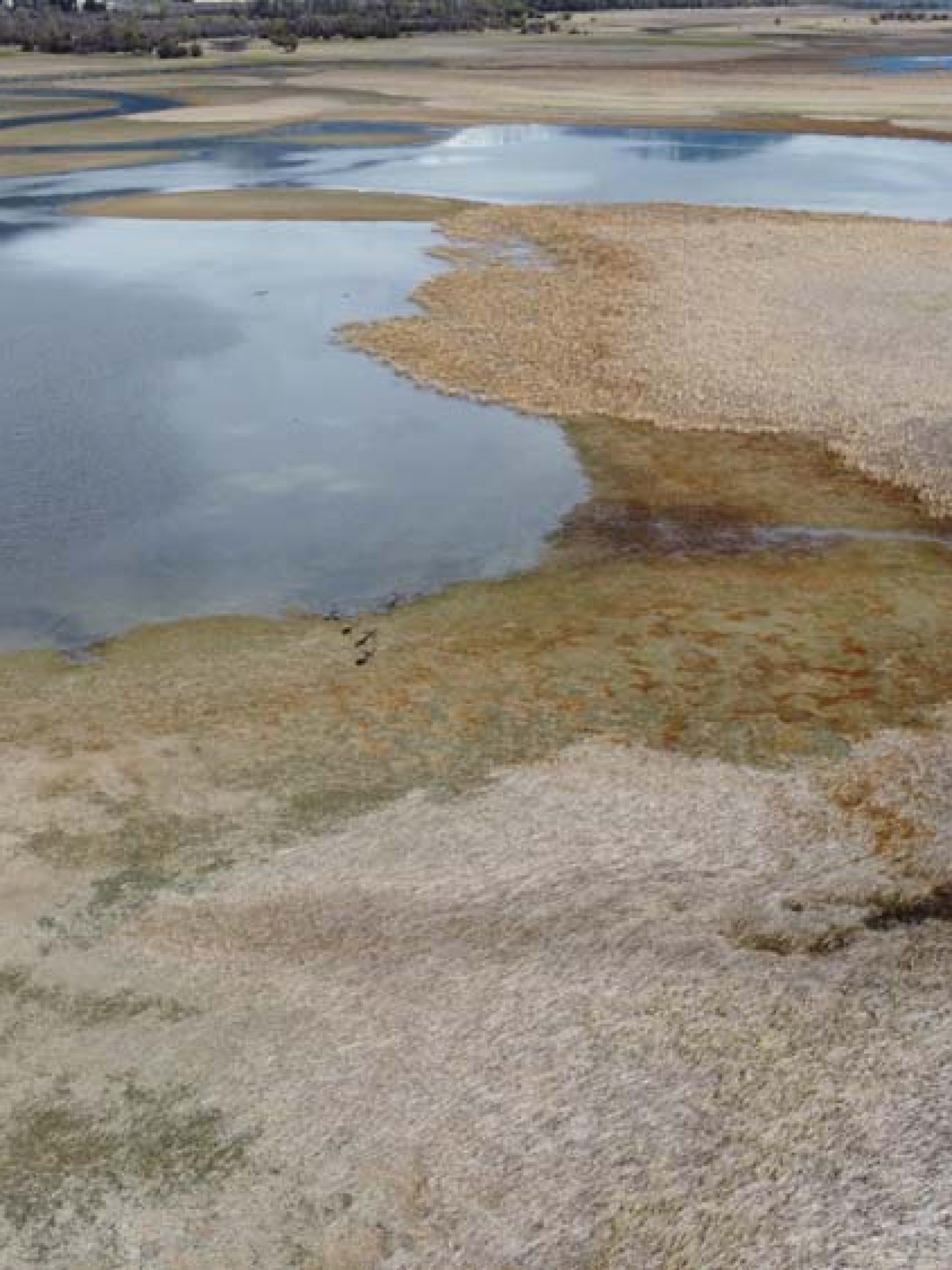
The Upper Columbia River and adjacent Columbia Wetlands are one of the largest wetland complexes in British Columbia. This 180 kilometre-long, biologically-rich system extends northward from Canal Flats to Donald within the Rocky Mountain Trench of the Canadian Rockies of southeastern British Columbia. Encompassing the northward-flowing Columbia River, this 26,000-hectare wetland system is also one of the few remaining pristine floodplain wetlands left in North America; and it contains the only undammed section of the entire 2,000 kilometre-long Columbia River. The Columbia Wetlands are a crucial source of freshwater, and provide immense habitat value to a diverse range of birds, fish, reptiles, amphibians, mammals, and invertebrates. This unique ecosystem is under pressure from anthropogenic sources and climate change. The severity and consequences of climate change are unknown and are being investigated in the CWSP project.
“Working in these wetlands offer constant breathtaking views of the surrounding mountains. Seeing the bright, snow-covered alpine areas while wading through the wetlands that rely on that water source offers a unique perspective on watershed connectivity and function,” said Kyle.
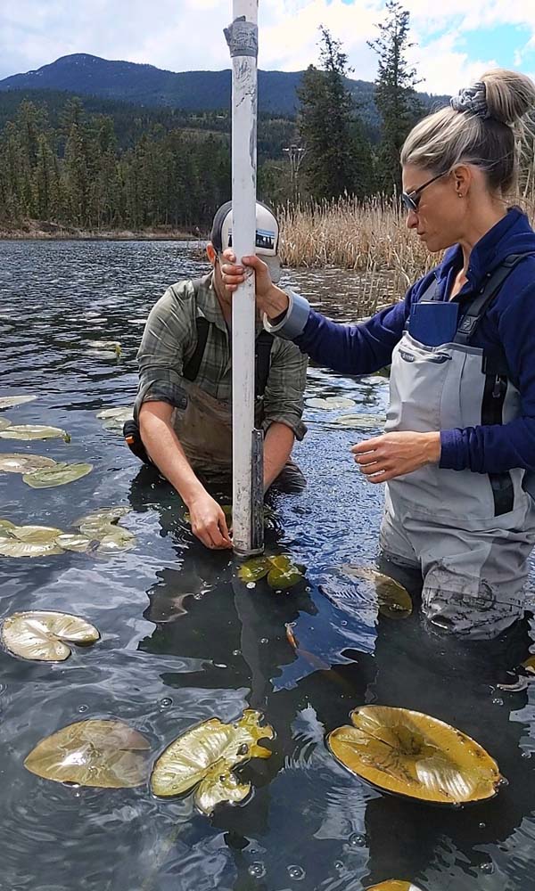
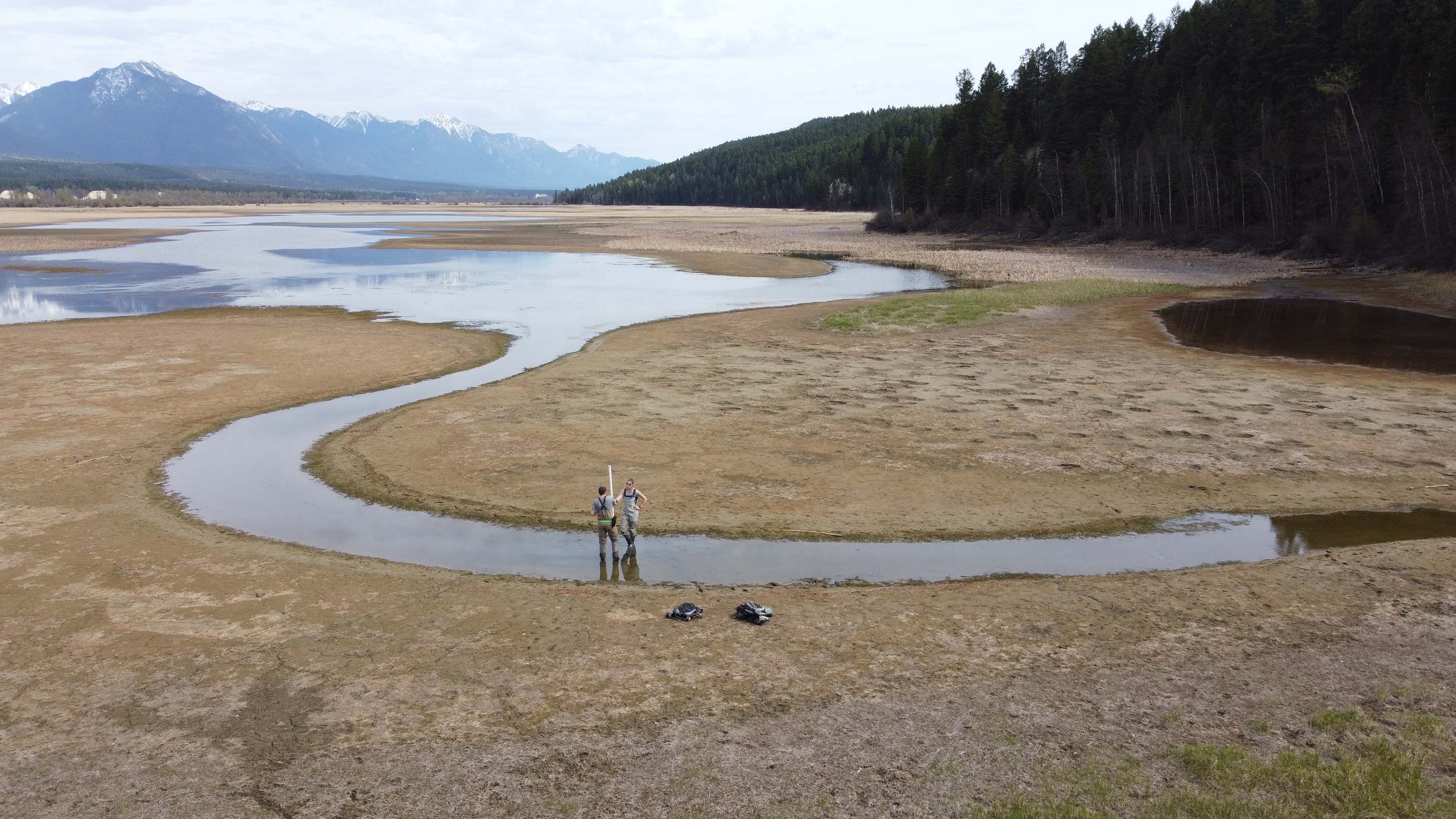
For this project, LLC assisted with the installation of water level and temperature loggers at over 40 sites in wetlands between Invermere and north of Spillimacheen. The sites had all types of access including some that were easily reached off the roadside, while others required hiking down steeper terrain or access via canoe. Small data logging devices were installed at each site, which will measure water level and temperature until removed in the late fall. Water quality measurements and samples were collected at all of the sites to understand changes between systems and possible groundwater influence.
CWSP has been working closely with various partners and MacDonald Hydrology Consultants Ltd. (MacHydro) to identify unique types of wetlands based on hydrology and previous vegetation mapping data. One major goal is to determine which wetland types are most vulnerable to effects from climate change and investigate mitigation solutions. Some of these solutions may involve understanding beaver activity, which CWSP and LLC will be exploring more in the 2021 field season.
To learn more, contact Kyle Prince: kyle@livinglakescanda.ca
All photos by Annie Pankovitch


